
The heights charm us but the steps do not; with the mountain in our view we love to walk the plains
Johann Wolfgang von Goethe
There’s a very short word that’s guaranteed to shiver Mr B’s timbers; that word is hill. Only when used in association with a walk, though – and to be accurate there are other words that have the same effect. Any mention of up, slope, climb, steep…and, God save us, summit!…will have him digging in his heels and refusing to budge. There’ve been several occasions when I’ve messed up by not reading all the way through a walk description and we’ve suddenly been confronted by a path snaking heavenwards into the blue or grey. At such times the outcome has been decided by weighing up our position along the route with the need for oxygen…
This week we got it right. We drove up to Keeper’s Pond, a landmark very familiar to everybody who lives in these parts. Its correct name is Pen Ffordd Goch pond, which means the pond at the top of the red road. It’s a man-made construction which was used to supply water during iron making times to the Garn Ddyrys forge just down the hill. Because there was a gamekeeper’s cottage nearby it soon became known as Keeper’s Pond in that lazy way that people have of labelling places. It sits just alongside the B4246 (the red road, though these days it’s a dirty grey) that takes traffic from the village of Gofilon over the top of the mountainside into Blaenafon. There’s a car park and a series of walking trails which have the benefit of being more-or-less flat.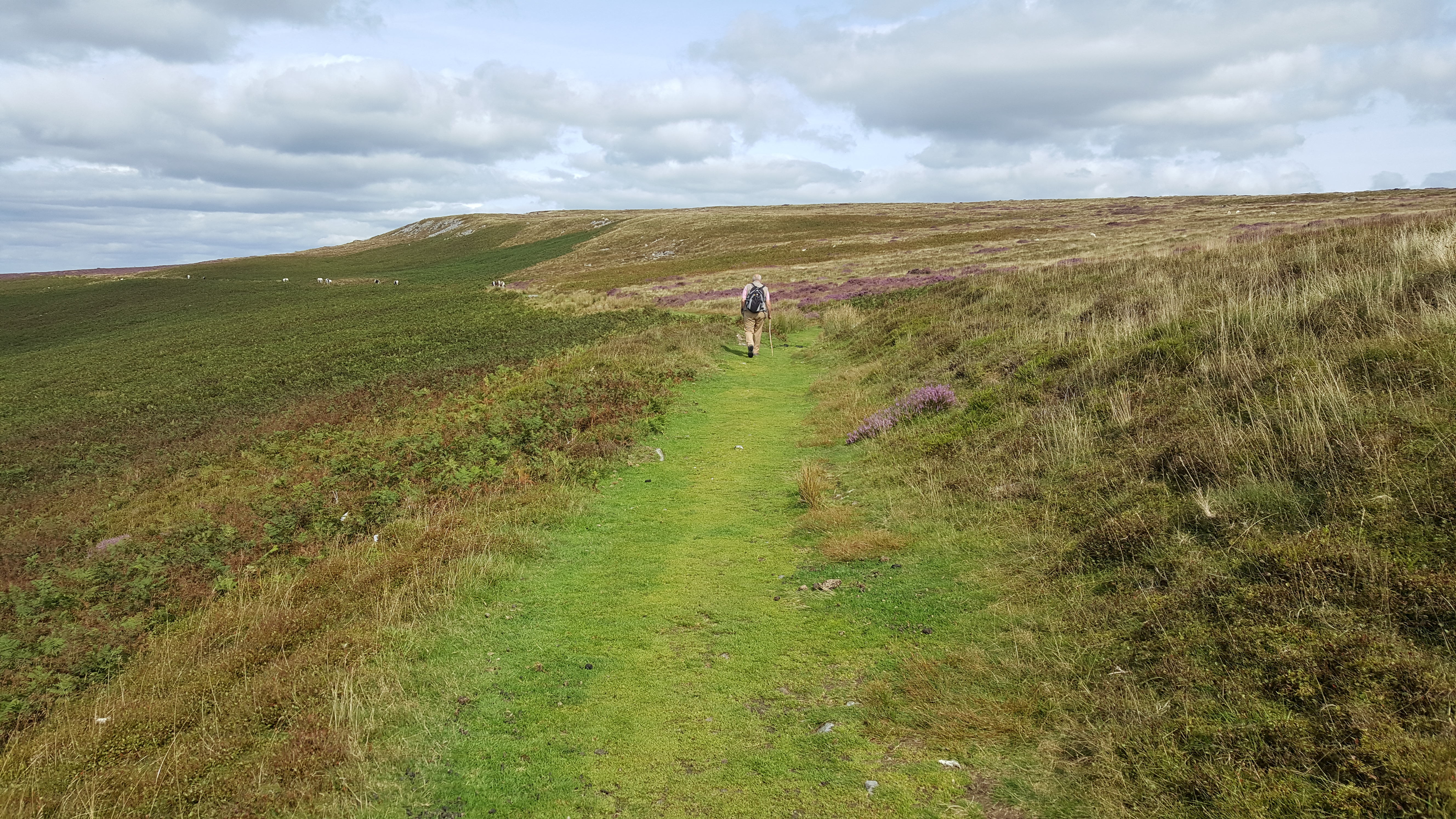
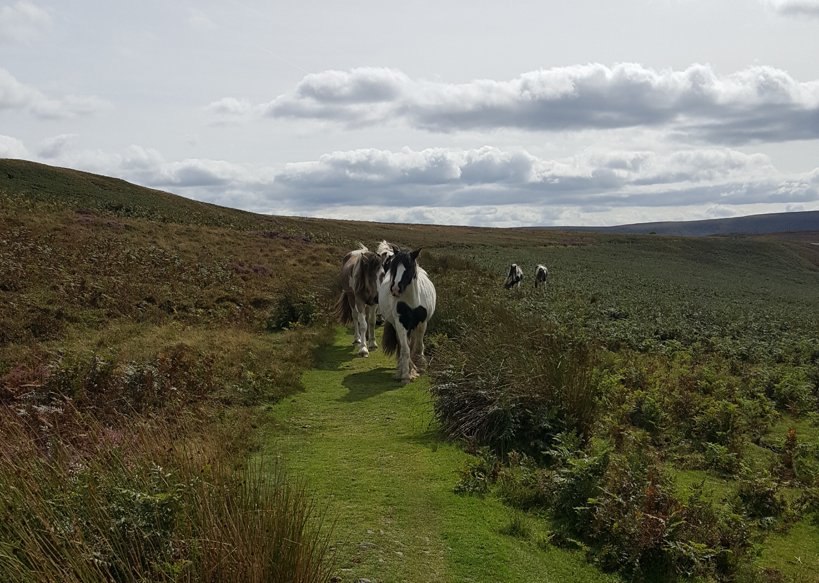
As it was a fine day we set off enthusiastically, skirting the pond and admiring the view as we went. The hills are ablaze with heather at this time of year but sadly my phone camera didn’t do justice to the colour. The path follows an old tramway for a while, yet another legacy of the recent past. Once part of the hell that was the Industrial Revolution it’s astonishingly quiet up here now, and apart from one other couple we met only a few sheep and a small herd of ponies. Unlike most of these semi-wild beasts they seemed not to want to move off the path when we approached. Even after we’d shimmied past they followed us for a while, probably thinking we had edible treats with us. No such luck, I’m afraid.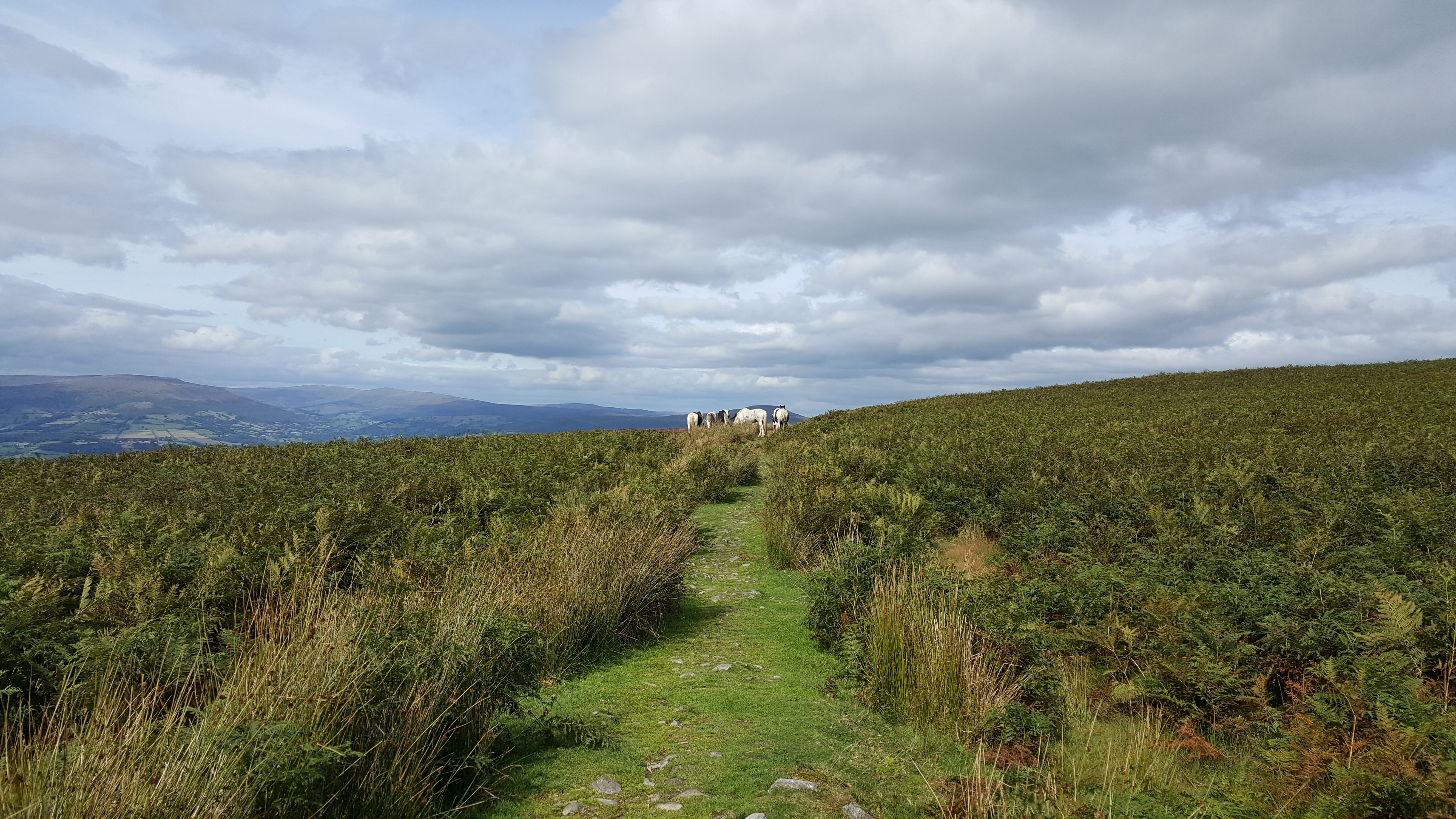
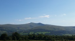
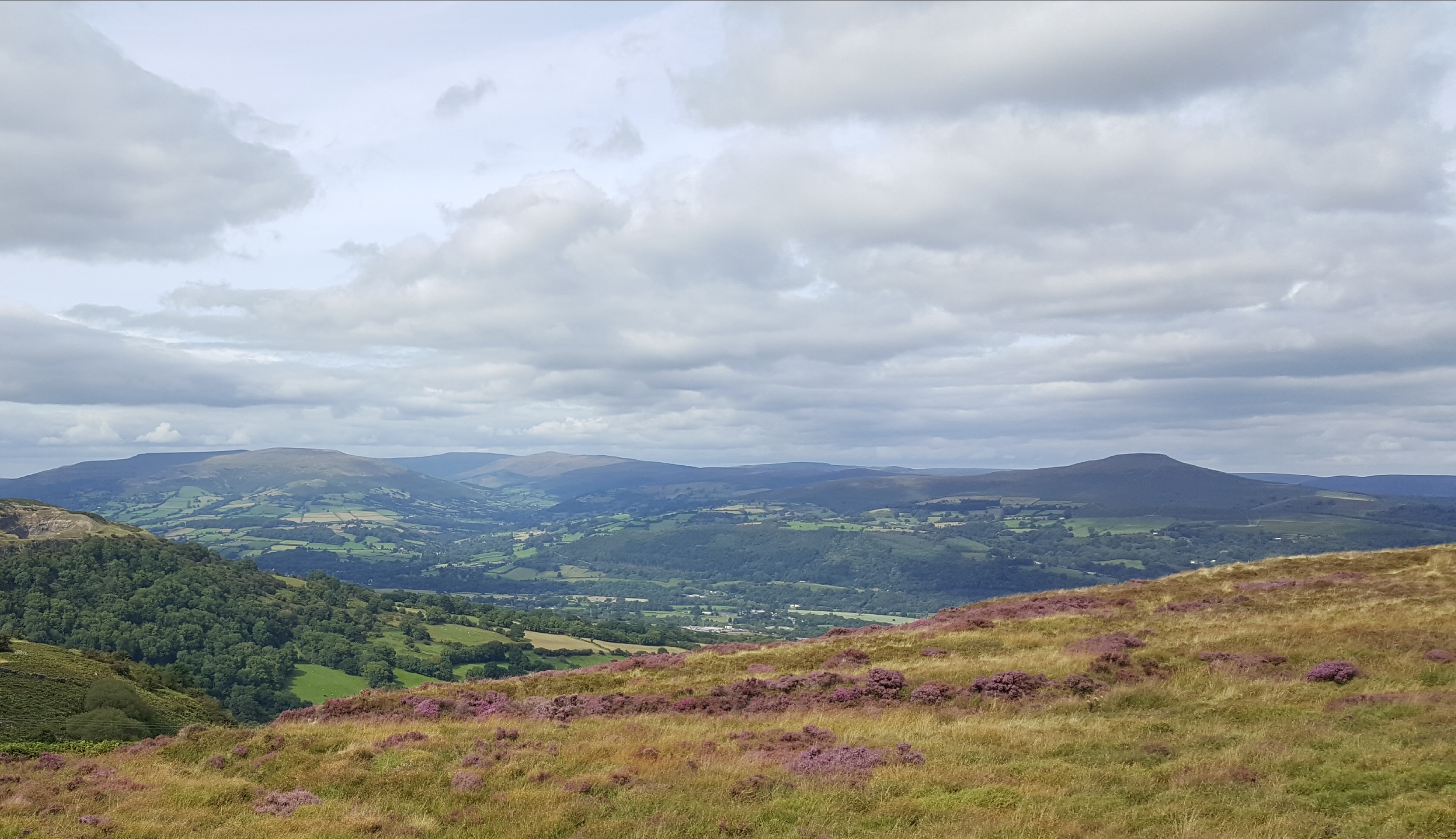
The path took us around the northern aspect of the Blorenge, probably the only word I know that rhymes with orange. From here there’s an outstanding view of the Black Mountains and of the towns and villages dotted along the Usk and the Monmouth & Brecon Canal, from Crickhowell over in the west through to Abergavenny below and the territories of Gwent over in the east. We could also clearly see the A465 making straight for Hereford, just west of the Skirrid mountain.
The trail here was close to the edge of the hill, a challenge for someone like me who’s a bit of a cupcake when it come to heights, though the sheep were showing off.
I was pretty sure as we tottered around that I’d read something, somewhere, about a battle being played out around here. Sure enough, when I got home I found this in J.Beverley Smith’s biography of Llywelyn ap Gruffudd: (Llywelyn’s) forces had evidently approached the area from the west and occupied the moorland terrain in the western portion of the lordship as far as the Blorenge mountain. They pressed upon the Usk south of Abergavenny by 1st March and wrought destruction in the areas accessible to them. This continued for two more days before the Marcher forces forded the river north of Abergavenny and attacked the Welsh flank. Smith continues: The move was daring, its results decisive. The main body of the prince’s army was forced to retreat up the slopes of the Blorenge and seek the safety of the mountainous tracts beyond. He also tells us that the English leaders were unable to go in pursuit. Well. I don’t blame them! How anyone managed to retreat up these slopes is astonishing, particularly on horseback – as some if not all of them would have been…maybe they built them more daring in 1263?
As we continued around we could see right across to the Bristol Channel, before the path veered to the right and took us up to the trig point. Hanging my head in shame I will tell you that this is only the second trig point we’ve encountered (the other is on Sugar Loaf, staring at us from across the Usk) and until I was asked what the identifying number was, I didn’t even know that the blessed things had numbers. My sister, however, is a determined collector of trig points and so I was admonished and told that if I didn’t have the number then I hadn’t been to the location – despite the fact I have photographic evidence. Apparently this could have been photoshopped…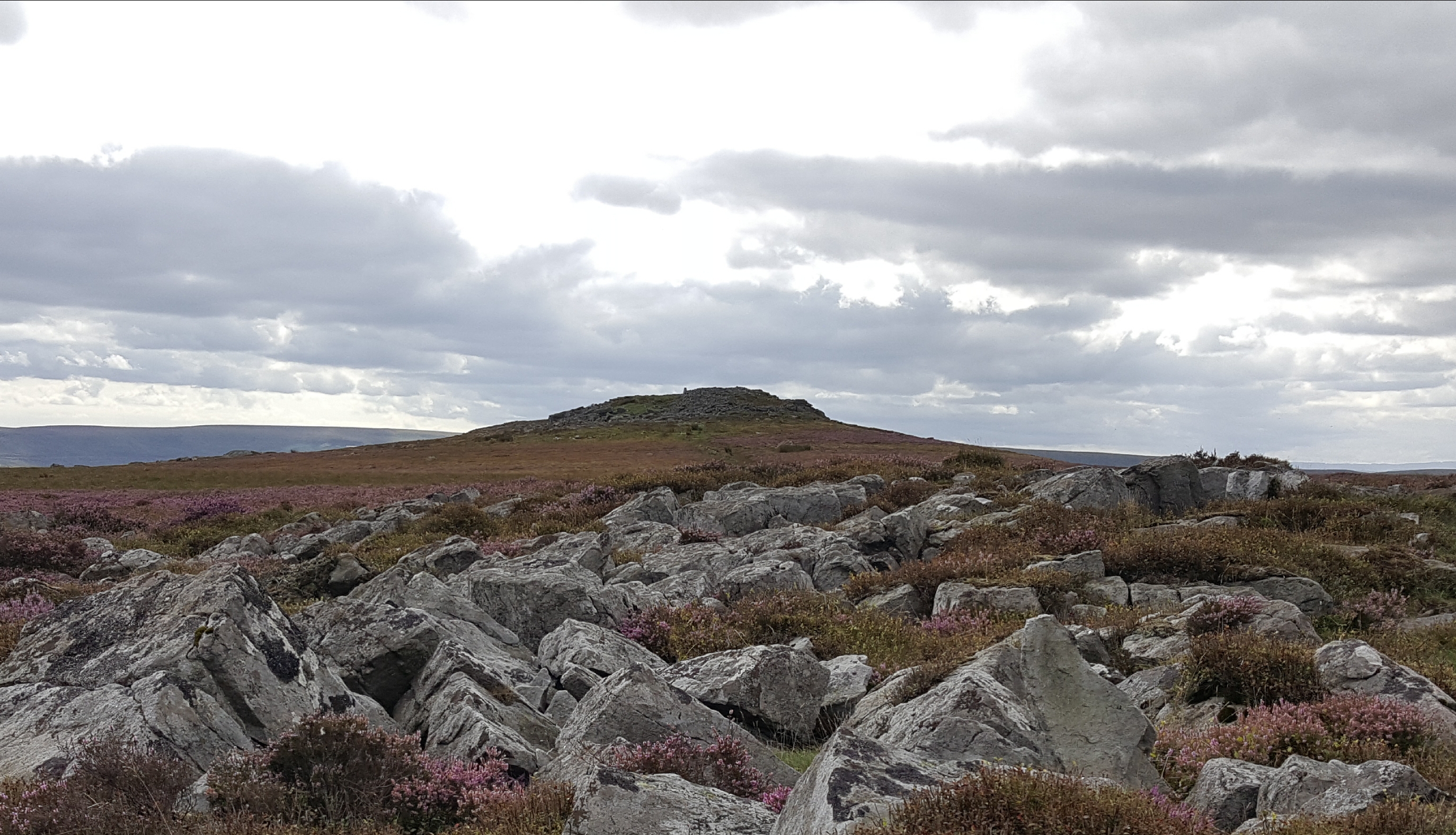
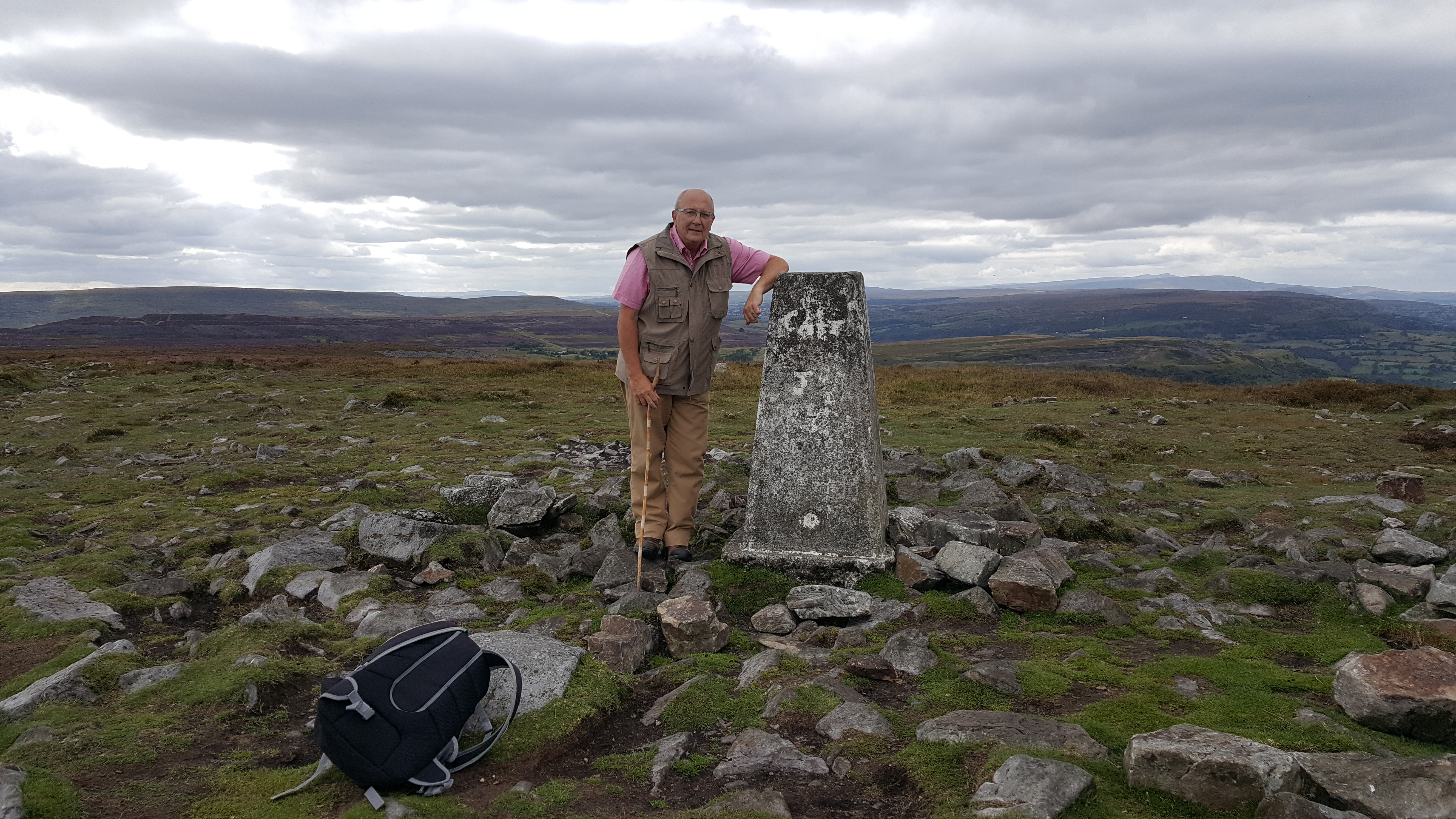
This was the only uphill trajectory that we took on the entire walk and I’m happy to say that it was dealt with easily. Before long we came aross the grave of the famous showjumping horse Foxhunter, which is an odd place to find a monument like this. Maybe the horse had enjoyed the views. The information board here was interesting, informing us that the Blorenge mountain is made of a hard rock called ‘millstone grit’ – known by the miners of the time as ‘farewell rock’ because it marked the edge of the South Wales coalfield and thus the point at which they were able to stop their labours and turn towards home. True to the acquisitional nature of mankind, another function was found for the rock (actually a type of sandstone); it was used to manufacture millstones, hence its name. As if to prove the point there are several abandoned millstones lying around. We made our way back to the car, enjoying the sight of Pen y Fan in the distance and also enjoying the sight of someone actually swimming in Keeper’s Pond.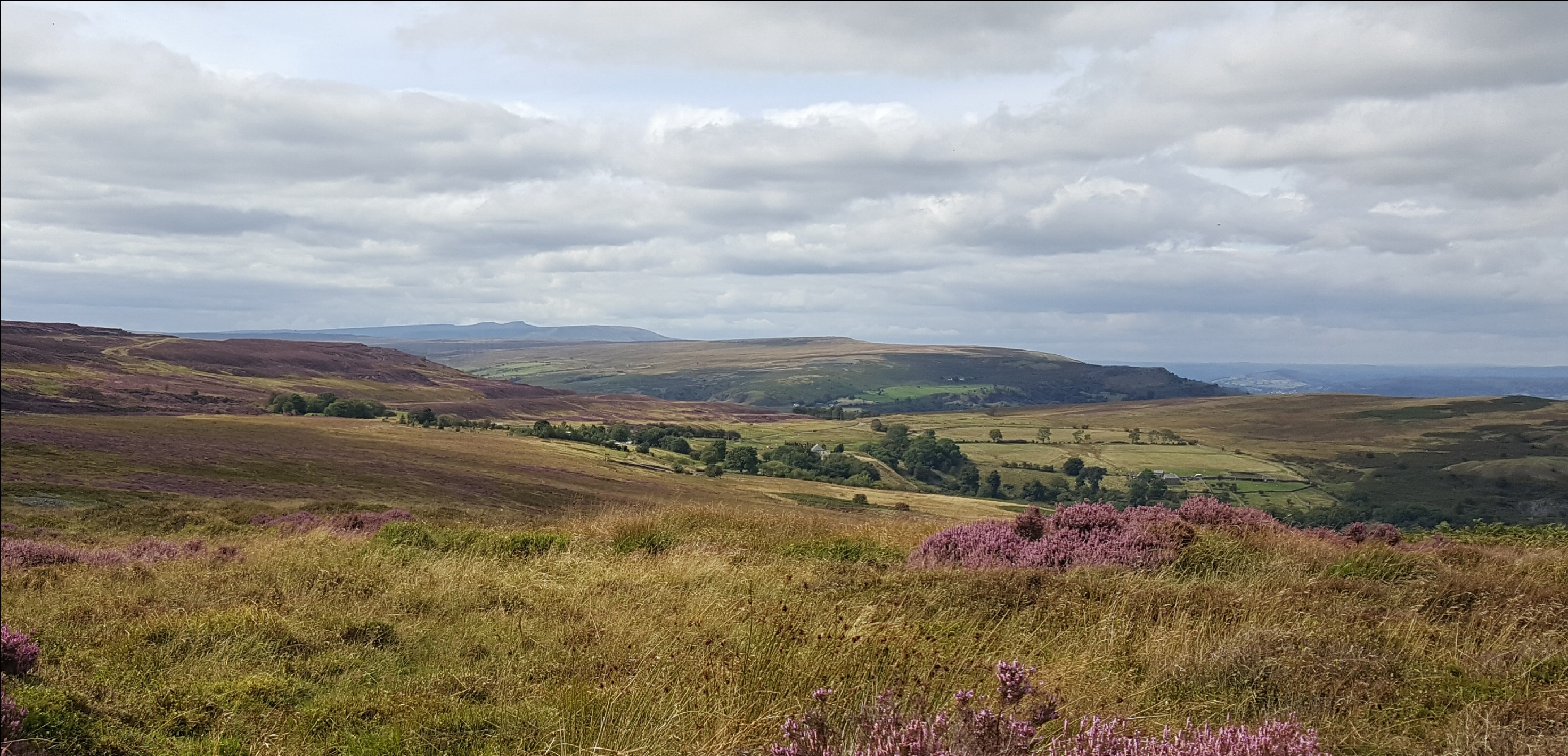
By the time we got home and did our usual cup-of-tea-put-our-feet-up regime we’d agreed that this was a walk worth repeating. Actually it may be a while before we need to repeat it because the exemplary www.visitblaenavon.co.uk gives details of several other routes in the area, exploring this post-industrial landscape. I’m trying to persuade Mr B that it’ll be worth a trip in the winter, particularly if we can encounter that other nightmare word of his…snow!
This is the land where men labour
in silence, and the rusted harrow
breaks its teeth on the grey stones
Below, the valleys are an open book,
bound in sunlight; but the green tale
told in its pages is not true
R.S. Thomas

Thanks Sandra. I’ve been meaning to read Resistance for a while – I really must get around to it but honestly, I don’t seem to have the time to read anything at the moment! You’re right, it is set around here, just to the north of Abergavenny – we live about 6 miles west of Abergavenny, just outside Crickhowell on the River Usk. I must read the book!
Do let me know if you ever get to read it. I’d love to hear your thoughts on it.
I thoroughly enjoyed reading this, Mrs B; I feel that I’ve done the walk now and can go straight for the tea-and-feet-up element, feeling totally immersed in your wonderful landscape and rich history. Well done on braving those high points; I’m a cupcake too!
More seriously, your description make me think of a novel I’m currently reading: Resistance by Owen Sheers. Have you come across it? I don’t have it in front of me but the sense of place makes me think it may be set quite close to your part of Wales.
Such a lovely post. It sounds like a spectacular walk.
Thank you ⚘ It was really enjoyable and the views were spectacular!